Top 25 Companies in the Interferometric Synthetic Aperture Radar Market: Company Profile by Transpire Insight
By Transpire Insight
Description
According to a research report published by Transpire Insight, the interferometric synthetic aperture radar market size is projected to grow from USD 632.45 million in 2026 to USD 1207.23 billion by 2035, at a CAGR of 10.26% during the forecast period 2027-2035. Growing demand for millimeter-accurate millimeter-scale land deformation tracking, critical infrastructure monitoring, expanding small-satellite commercial SAR constellations, and rising defense investments drive Interferometric Synthetic Aperture Radar (InSAR) adoption across civil engineering, environmental, and defense sectors.
Introduction
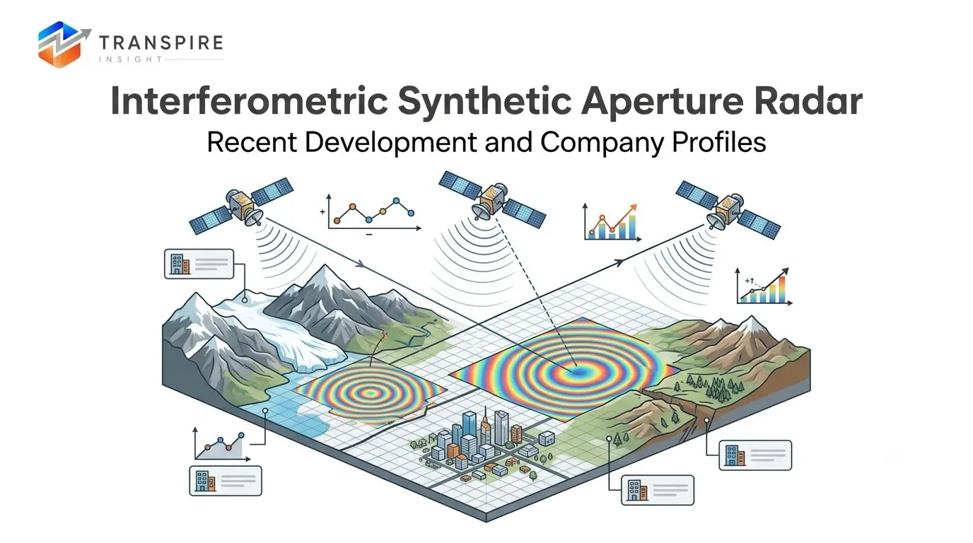
Interferometric Synthetic Aperture Radar (InSAR) is a non-invasive remote sensing technique that compares complex phase information across multiple radar images to detect surface displacement with sub-centimeter accuracy. Essential for geotechnical safety, hazard mitigation, structural engineering, and defense monitoring, InSAR provides all-weather, day-night observation capabilities. As space-based commercial radar constellations expand, InSAR technology is transitioning from high-cost, specialized satellite missions into real-time, cloud-enabled geospatial monitoring workflows worldwide.
Recent Development News
- February 2026: Airbus Defence and Space signed a major European defense update agreement to scale high-resolution spaceborne SAR monitoring systems for continuous national security mapping.
- May 2026: ICEYE expanded its commercial Earth-observation constellation, launching advanced micro-satellites offering persistent sub-daily revisit capabilities for automated millimeter-level infrastructure deformation tracking.
Stay Ahead of Emerging Opportunities with Expert Market Insights by Transpire Insight
Transpire Insight provides comprehensive, data-driven market intelligence to support smarter business decisions. Our research is rooted in comprehensive analysis, authoritative predictions, and industry expertise, enabling organizations to make informed decisions in rapidly evolving markets. In-depth analysis of market segmentation, competitive positioning, regional trends, and emerging investment opportunities in high-growth areas. We blend accuracy with actionable intelligence, empowering companies to uncover new avenues for growth, bolster strategic decision-making, and stay ahead in a dynamic market.
Download the exclusive Interferometric Synthetic Aperture Radar Market sample report today to explore expert insights, key trends, and emerging opportunities shaping the future of the industry.
Interferometric Synthetic Aperture Radar Market Size & Statistics
- The Market Size for Interferometric Synthetic Aperture Radar Was Estimated to be Worth USD 632.45 Billion in 2026.
- The Market Size is Going to Expand at a CAGR of 10.26% between 2026 and 2035.
- The Interferometric Synthetic Aperture Radar Market Size is anticipated to reach USD 1207.3 Billion by 2035.
- North America is projected to drive the highest demand during the forecast period, accounting for 33.5% of the interferometric synthetic aperture radar market.
- Asia-Pacific is projected to grow the fastest during the forecast period at a CAGR of 10.6% in the interferometric synthetic aperture radar market.
Regional Growth and Demand Analysis by Transpire Insight
North America's dominance rests on deep, sustained investment from federal agencies such as NASA and the USGS, which rely on InSAR for national hazard monitoring and infrastructure resilience programs. Defense primes including Lockheed Martin, Northrop Grumman, Raytheon/RTX, and Airbus Defence and Space continue to anchor the region's supply base, while commercial players such as Capella Space have introduced InSAR-optimized SAR satellite constellations built for rapid revisit and consistent imaging geometry. This blend of government funding and private-sector innovation keeps North America's demand base broad, spanning defense, infrastructure monitoring, and energy applications, and reinforces the region's lead even as growth accelerates elsewhere.
Asia-Pacific's momentum is being driven by China, India, and Japan, all of which are funding national radar satellite programs and folding InSAR into their earth observation systems. The India-U.S. NISAR mission is a standout example, reflecting the scale of cross-border collaboration now shaping the region's capabilities. Rapid urbanization, dense construction activity, and heightened exposure to earthquakes, landslides, and land subsidence are pushing governments and commercial operators to adopt InSAR for continuous ground-deformation tracking. Rising investment in earth observation satellites and geospatial technology firms across the region signals that Asia-Pacific's growth trajectory is likely to persist well beyond the near term.
Top 15 Trends in the InSAR Market
- Rising adoption of AI and machine learning analytics.
- Expansion of multi-satellite constellations for frequent revisit.
- Growing infrastructure monitoring and structural health applications.
- Increasing use of cloud-based InSAR processing platforms.
- Rising demand from oil, gas, and mining sectors.
- Growth in disaster risk and hazard monitoring.
- Expanding defense and government space program investments.
- Advances in phase unwrapping and interferogram algorithms.
- Miniaturization of SAR payloads for small satellites.
- Increasing commercial satellite manufacturing capabilities.
- Rising urban subsidence and ground deformation monitoring.
- Integration of InSAR with GIS and geospatial platforms.
- Growth in environmental and climate change monitoring.
- Expansion of public-private satellite partnerships.
- Rising adoption of multi-image stacking techniques.
Proceed to checkout to purchase the exclusive Interferometric Synthetic Aperture Radar Market report and get instant access to detailed market insights, strategic analysis, and future growth opportunities.
AI and Machine Learning Analytics
Artificial intelligence and machine learning algorithms now process InSAR data faster, automatically detecting deformation patterns and improving accuracy across infrastructure, mining, and environmental monitoring applications.
Multi-Satellite Constellations
Satellite operators are launching multi-satellite constellations enabling higher-frequency revisit cycles, allowing near-continuous ground monitoring, faster disaster response, and improved temporal resolution for precise surface tracking.
Infrastructure Monitoring
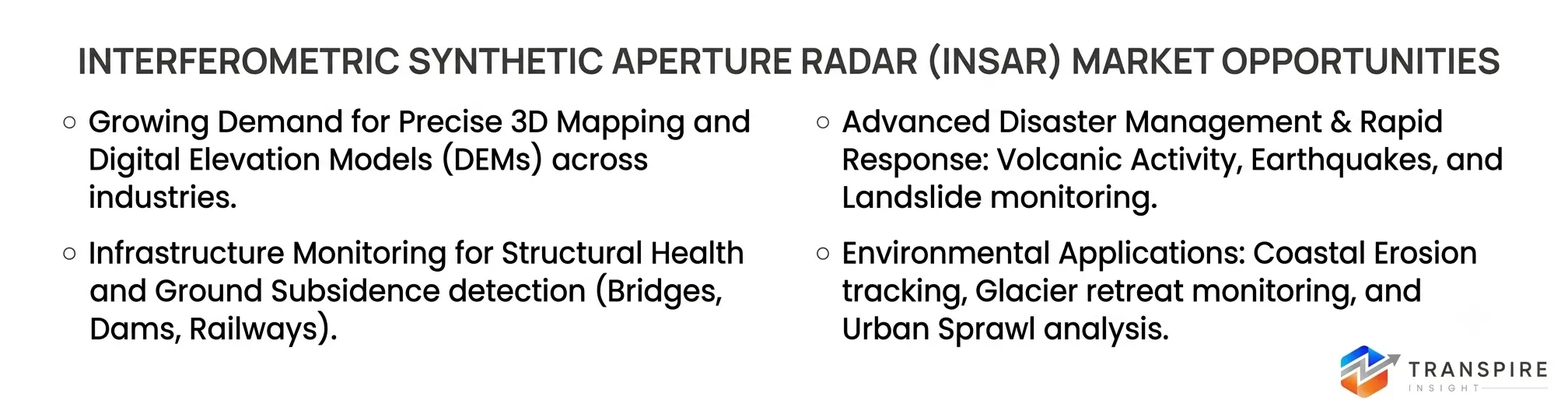
Governments and private operators increasingly use InSAR to monitor bridges, dams, pipelines, and buildings for structural weaknesses, reducing reliance on manual inspections and preventing failures.
Oil, Gas, and Mining Demand
Energy and mining companies deploy InSAR to track surface subsidence near extraction sites, pipelines, and storage facilities, supporting operational safety, compliance, and reduced environmental risk.
Disaster Risk and Hazard Monitoring
InSAR technology helps detect early warning signs of earthquakes, landslides, floods, and volcanic activity, enabling governments to respond quickly and reduce casualties during natural disasters.
Miniaturization of SAR Payloads
Smaller, lighter SAR payloads now fit compact smallsat platforms, letting emerging space companies launch cost-effective constellations that expand coverage, increase revisit frequency, and lower costs.
List of Top 25 Companies Leading the Interferometric Synthetic Aperture Radar Market
- Airbus Defence and Space
- Raytheon Technologies (RTX)
- Lockheed Martin Corporation
- Northrop Grumman Corporation
- Thales Group
- MDA Space
- ICEYE
- Capella Space
- TRE Altamira
- Synspective
- CGG (Viridien)
- BriskGeo (3D Laser Mapping / GEOKON)
- IDS GeoRadar (Hexagon AB)
- GroundProbe (Orica Company)
- IQGeo Group
- Fugro
- Planet Labs PBC
- Ursa Space Systems
- Umbra Lab
- OHB SE
- General Atomics Aeronautical Systems
- Israel Aerospace Industries (IAI)
- BAE Systems
- Hensoldt
- e-GEOS (Telespazio / ASI)
Customize the exclusive Interferometric Synthetic Aperture Radar Market report to receive insights tailored to your needs, including country-specific analysis and business-focused market intelligence.
- Airbus Defence and Space
Delivers high-precision spaceborne SAR imagery via its TerraSAR-X and PAZ constellations.Founded: 2014 | HQ: Taufkirchen, Germany.Why It Ranks: Dominates European Earth observation, space infrastructure, and defense-grade orbital SAR operations.Regional Dominance: Leads European military and commercial spaceborne synthetic radar remote sensing markets.Product Line: TerraSAR-X, TanDEM-X constellation services, and customized radar imagery processing tools.
- Raytheon Technologies (RTX)
Provides defense-scale high-resolution radar sensors, processing algorithms, and integrated space systems.Founded: 1922 | HQ: Arlington, Virginia, USA.Why It Ranks: Commands major market share in advanced radar defense systems.Regional Dominance: Dominates North American defense department radar and intelligence surveillance contracting.Product Line: Advanced military SAR sensor suites, airborne radars, and signal processing.
- Lockheed Martin Corporation
Engineers space vehicles, defense radar systems, and complex Earth observation platforms.Founded: 1995 | HQ: Bethesda, Maryland, USA.Why It Ranks: Key contractor for high-budget military, aerospace, and government radar initiatives.Regional Dominance: Unmatched structural hold on US government and defense aerospace satellite contracts.Product Line: Tactical radar platforms, satellite payloads, and space-based ground intelligence systems.
- Northrop Grumman Corporation
Develops mission-critical tactical SAR components, space sensors, and aerial surveillance radar.Founded: 1994 | HQ: Falls Church, Virginia, USA.Why It Ranks: Leading provider of airborne defense and intelligence radar systems.Regional Dominance: Major market leadership across North America and allied Western defense programs.Product Line: Airborne reconnaissance radars, satellite sensor payloads, and tactical surveillance hardware.
- Thales Group
Engineers advanced radar payloads, satellite communication equipment, and spatial data systems.Founded: 2000 | HQ: La Défense, France.Why It Ranks: World-class leader in European space electronics, satellite manufacturing, and radar.Regional Dominance: Strong market hold across Europe, the Middle East, and Asia-Pacific.Product Line: Spaceborne radar instruments, radar signal processors, and civil security infrastructure.
- MDA Space
Pioneered commercial spaceborne radar with the iconic RADARSAT series and defense constellations.Founded: 1969 | HQ: Brampton, Ontario, Canada.Why It Ranks: Premier commercial provider of satellite radar imagery and space robotics systems.Regional Dominance: Dominates Canadian space sector and maintains heavy footprint across North America.Product Line: RADARSAT imagery, spaceborne SAR antennas, and geospatial intelligence satellite platforms.
- ICEYE
Pioneered high-frequency persistent Earth monitoring using a massive small-SAR satellite constellation.Founded: 2014 | HQ: Espoo, Finland.Why It Ranks: Operates the world's largest commercial constellation of micro-SAR radar observation satellites.Regional Dominance: Rapidly expanding footprint across European, American, and commercial geospatial sectors.Product Line: High-revisit commercial SAR imagery, change detection services, and InSAR analytics.
- Capella Space
Provides high-resolution, on-demand sub-meter SAR imaging via an automated satellite network.Founded: 2016 | HQ: San Francisco, California, USA.Why It Ranks: Industry innovator in ultra-high-resolution, low-latency commercial satellite radar observations.Regional Dominance: Leads commercial small-satellite high-resolution SAR data supply within North America.Product Line: High-resolution X-band SAR imagery, automated analytics platforms, and change monitoring.
- TRE Altamira
Specializes exclusively in advanced processing of spaceborne InSAR data for geotechnical monitoring.Founded: 2000 | HQ: Milan, Italy.Why It Ranks: benchmark standard for processing land displacement and infrastructure deformation analytics.Regional Dominance: Broad market reach across Europe, North America, and mining sectors.Product Line: SqueeSAR processing technology, persistent scatterer InSAR, and ground movement services.
- Synspective
Integrates small-satellite SAR constellations with automated AI analytics for civil ground monitoring.Founded: 2018 | HQ: Tokyo, Japan.Why It Ranks: Fast-growing Asian leader deploying dedicated SAR satellites for urban infrastructure monitoring.Regional Dominance: Holds strong dominance in Asia-Pacific environmental hazard and urban monitoring markets.Product Line: StriX satellite constellation, Land Displacement Monitoring (LDM), and disaster analysis.
Schedule a meeting with our market experts to discuss the exclusive Interferometric Synthetic Aperture Radar Market report and find the right research solution for your business.
Conclusion
The Interferometric Synthetic Aperture Radar (InSAR) market is experiencing rapid expansion as satellite constellations increase revisit frequencies and lower data costs. Fueled by critical infrastructure management, defense surveillance, and AI-driven predictive analytics, InSAR is shifting from niche scientific study to mainstream commercial operations. Key defense prime contractors and innovative commercial satellite providers will continue shaping market growth, establishing InSAR as an essential standard for risk mitigation and Earth observation.



 inquiry@transpireinsight.com
 APAC:+91 7666513636
 Address


