
Oct 26, 2026
By Transpire Insight
Description
According to a research report published by Transpire Insight, the geospatial analytics artificial intelligence market size is projected to grow from USD 110.3 billion in 2026 to USD 227.23 billion by 2035, at a 11.97% CAGR during the 2027-2035 forecast period. Rising demand for real-time location intelligence, integration of computer vision with satellite imagery, expanding smart city infrastructure, and automated disaster management drive market expansion rapidly.
Introduction
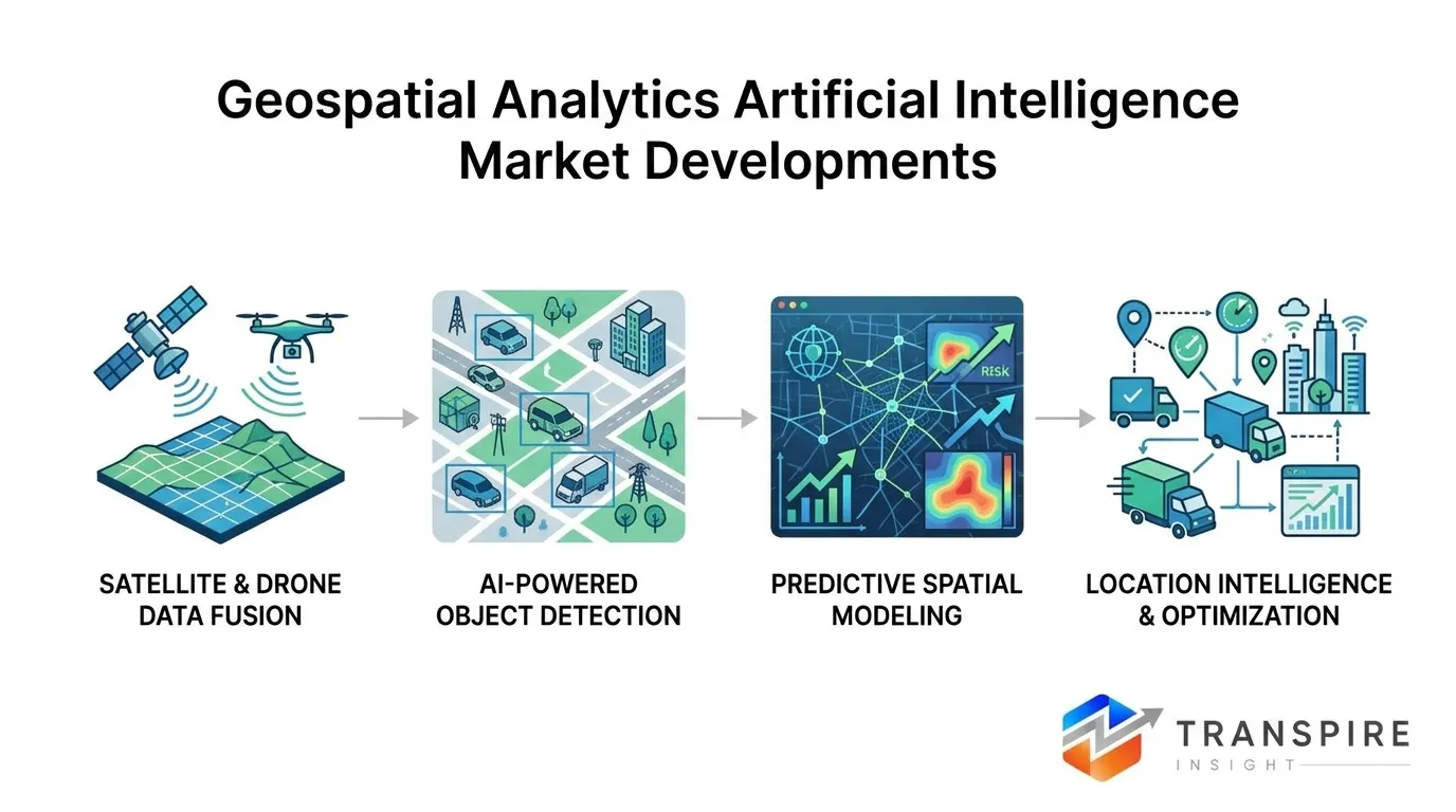
The Geospatial Analytics Artificial Intelligence Market is experiencing explosive growth as organizations combine location-based data with deep learning models. By automating object detection, change recognition, and predictive mapping, GeoAI converts massive satellite, drone, and IoT feeds into actionable insights. Industries ranging from urban planning to climate risk modeling leverage these capabilities to optimize assets and enhance decision-making, cementing GeoAI as a pivotal technology across commercial and enterprise sectors.
Recent Development News
April 2026: Oman issued Royal Decree 43/2026 establishing a framework for national geospatial data, while the Open Geospatial Consortium (OGC) launched the JSON-FG standard in May 2026 to streamline GeoAI API integrations.
June 2026: Major breakthroughs emerged in city-scale 3D scene generation, followed by Esri releasing HydroSHEDS v2 in July 2026 utilizing TanDEM-X elevation inputs to power AI-driven climate resilience models.
Stay Ahead of Emerging Opportunities with Expert Market Insights by Transpire Insight
Transpire Insight provides comprehensive, data-driven market intelligence to support smarter business decisions. Our research is rooted in comprehensive analysis, authoritative predictions, and industry expertise, enabling organizations to make informed decisions in rapidly evolving markets. We provide in-depth analysis of market segmentation, competitive positioning, regional trends, and emerging investment opportunities in high-growth areas. We blend accuracy with actionable intelligence, helping companies uncover new growth avenues, strengthen strategic decision-making, and stay ahead in a dynamic market.
Geospatial Analytics Artificial Intelligence Market Size & Statistics
The Market Size for Geospatial Analytics Artificial Intelligence Was Estimated to be Worth USD 110.3 Billion in 2026.
The Market Size is Going to Expand at a CAGR of 11.97% between 2026 and 2035.
The Geospatial Analytics Artificial Intelligence Market Size is anticipated to reach USD 227.23 Billion by 2035.
North America is projected to drive the highest demand during the forecast period, accounting for 37.48% of the geospatial analytics artificial intelligence market.
Asia-Pacific is projected to grow the fastest during the forecast period at a CAGR of 25.8% in the geospatial analytics artificial intelligence market.
Regional Growth and Demand Analysis by Transpire Insight
North America leads the market because of deep federal investment, a dense base of platform vendors, and mature cloud infrastructure. Government and defense agencies remain anchor buyers, using AI to process satellite and aerial imagery for national security, climate monitoring, and disaster response. NASA and IBM jointly released the Prithvi geospatial foundation model for Earth observation, and Google DeepMind’s AlphaEarth Foundations turns satellite data into reusable embeddings that developers can plug into mapping workflows. Esri, Google, Planet Labs, and Trimble keep embedding AI into their commercial platforms, which sustains demand from utilities, insurers, agriculture, and transportation operators across the United States and Canada.
Asia-Pacific is growing fastest as smart city initiatives and agricultural technology push governments and enterprises toward AI-based spatial analysis. In India, the National Remote Sensing Centre uses AI to predict droughts and water shortages, so local authorities can plan water use in advance. The National Geospatial Policy has also opened wider access to geospatial data for private firms and startups. Across China, Japan, and South Korea, smart city, precision agriculture, and disaster-monitoring projects increasingly depend on steady streams of satellite and drone imagery. Cheaper satellite data and cloud platforms are lowering entry barriers for local developers and adding steady new demand.
Top 15 Trends in the Geospatial Analytics Artificial Intelligence Market
Geospatial foundation models enabling scalable Earth observation analysis
Pretrained models like Prithvi and AlphaEarth let organizations classify land cover, detect change, and monitor assets across regions without building bespoke algorithms for every task.
Generative AI transforming map creation and spatial querying
Natural-language interfaces let non-specialists query maps, generate spatial summaries, and produce synthetic training imagery, widening adoption beyond trained GIS analysts and speeding up decision cycles.
Digital twins powering urban planning and infrastructure management
Governments and utilities combine AI with live spatial data to simulate traffic, energy, and flooding scenarios, improving infrastructure planning and reducing construction and maintenance errors.
Cloud-native geospatial platforms replacing legacy desktop GIS
Scalable cloud platforms process massive imagery archives on demand, lowering upfront costs and letting smaller organizations access advanced geospatial AI without maintaining expensive on-premises infrastructure.
Precision agriculture using AI-driven crop and soil analytics
Farmers use AI on satellite and drone imagery to track crop health, soil moisture, and yield, enabling targeted inputs that cut costs and improve productivity.
Climate risk modeling and disaster prediction using GeoAI
Insurers, governments, and energy firms apply GeoAI to model floods, wildfires, and sea-level rise, turning spatial data into early warnings and more accurate risk pricing.
List of Top 25 Companies Leading the Geospatial Analytics Artificial Intelligence Market
Esri
Market leader pioneering geographical information system software and advanced location intelligence solutions.
Founded: 1969 | HQ: Redlands, California, United States.
Why It Ranks: Dominates enterprise GIS markets through its comprehensive ArcGIS GeoAI suite.
Regional Dominance: Strongest presence across North America, Europe, and rapidly expanding in Asia.
Product Line: ArcGIS Pro, ArcGIS Online, ArcGIS Velocity, GeoAI Machine Learning tools.
Google (Alphabet Inc.)
Tech giant integrating cloud computing with massive mapping and Earth analysis platforms.
Founded: 1998 | HQ: Mountain View, California, United States.
Why It Ranks: Unmatched planetary-scale imagery processing via Google Earth Engine and Maps API.
Regional Dominance: reach with widespread dominance across North America and Europe.
Product Line: Google Earth Engine, Google Maps Platform APIs, BigQuery Geo AI.
Hexagon AB
sensor, software, and autonomous solutions leader driving digital reality transformation.
Founded: 1992 | HQ: Stockholm, Sweden.
Why It Ranks: Industry-leading reality capture sensors coupled with spatial machine learning software tools.
Regional Dominance: High penetration across European industrial markets and North American infrastructure sectors.
Product Line: ERDAS IMAGINE, Luciad, M.App Enterprise, Hexagon Digital Reality Platform.
Trimble Inc.
Hardware and software integration leader specializing in positioning, modeling, and analytics.
Founded: 1978 | HQ: Westminster, Colorado, United States.
Why It Ranks: Deep integration of physical field sensors with AI-driven predictive spatial analytics.
Regional Dominance: Strong stronghold across North America, Latin America, and Australia.
Product Line: Trimble Business Center, eCognition GeoAI, Trimble Catalyst, RealWorks.
TomTom N.V.
Independent location technology specialist offering real-time traffic data and high-definition maps.
Founded: 1991 | HQ: Amsterdam, Netherlands.
Why It Ranks: Essential provider of AI-driven navigation and autonomous vehicle location data.
Regional Dominance: Dominates European automotive mapping with extensive North American enterprise partnerships.
Product Line: Orbis Maps, TomTom Traffic APIs, Maps SDK, Navigation SDK.
Planet Labs PBC
Operates the world’s largest constellation of Earth-imaging satellites capturing daily changes.
Founded: 2010 | HQ: San Francisco, California, United States.
Why It Ranks: Provides daily satellite imagery paired with automated machine learning detection.
Regional Dominance: Strong presence across North American defense, agriculture, and commercial sectors.
Product Line: PlanetScope, SkySat, Planet Insights Platform, Planetary Variables.
Maxar Technologies
Provider of high-resolution satellite imagery, 3D data, and spatial intelligence.
Founded: 1969 | HQ: Westminster, Colorado, United States.
Why It Ranks: Top supplier of defense-grade satellite imagery and automated change-detection algorithms.
Regional Dominance: Dominates North American defense and national security geospatial analytics markets.
Product Line: SecureWatch, Vivid Maps, GlobeNotification, Geospatial AI Data Services.
CARTO
Cloud-native spatial analytics platform enabling location intelligence inside modern data warehouses.
Founded: 2012 | HQ: New York City, New York, United States.
Why It Ranks: Pioneer in conversational AI agents and spatial SQL cloud integration platforms.
Regional Dominance: Strong market footprint across Western Europe and North American retail networks.
Product Line: CARTO Builder, CARTO Workflows, Spatial Extension for BigQuery/Snowflake.
Mapbox
Location data platform powering custom interactive maps for millions of applications.
Founded: 2010 | HQ: Washington, D.C., United States.
Why It Ranks: Preferred platform for developer-first customized mapping and real-time navigation AI.
Regional Dominance: Massive developer footprint across North America, Europe, and Asia.
Product Line: Mapbox Navigation SDK, Dash, Studio, Traffic Data APIs.
HERE Technologies
Leading location data and technology platform owned by major automotive consortia.
Founded: 1985 | HQ: Eindhoven, Netherlands.
Why It Ranks: Powerhouse in automotive location intelligence, fleet routing, and HD mapping.
Regional Dominance: European market leader with deep penetration into North American automotive markets.
Product Line: HERE Workspace, HERE Anonymizer, HERE HD Live Map, ISA Map.
Conclusion
The Geospatial Analytics Artificial Intelligence market represents a transformative leap in how organizations interpret physical environments. By automating spatial feature extraction, predictive modeling, and digital twin creation, GeoAI converts satellite feeds into tactical decisions. As cloud-native architectures dissolve processing bottlenecks, market leaders continue to push precision thresholds. Moving forward, integrated geospatial intelligence will remain essential for driving sustainability, urban resilience, and operational efficiency globally.


Send us a brief description of your challenge and we'll get back to you within 24 hours.

 inquiry@transpireinsight.com
 APAC:+91 7666513636
 Address


